Satellite Fire Detection
Geographic and Social Analysis
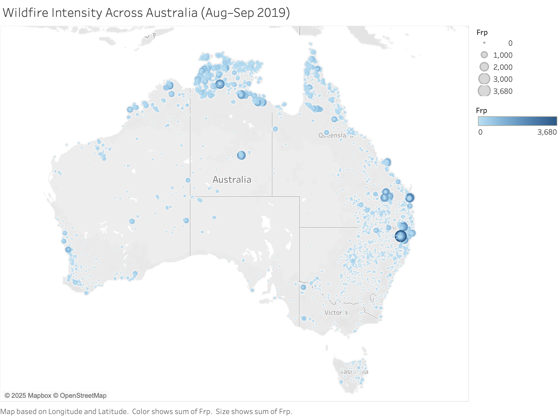
The map reveals several spatial clusters of high-intensity fires along the eastern and northern coastlines of Australia. The area observed to have the most significant fire detections naturally involved fire detection in rural settlements, environmentally-sensitive land, and agricultural lands. The southern side of Australia has settlements near coastal urban regions (Sydney and Brisbane) that produced significant accumulations of fire radiative power and thereby inflicted a greater risk of injury to life, property, and infrastructure. Conversely, there were fewer detections in central Australia, supporting the view that climate vulnerabilities are correlated with both population and biome distributions. The use of the maps both size and color helped to indicate not where fires occurred but where most fire intensity happened with implications for disaster response and ecological recovery for critical zones of impact.